ザ・サンダーボルツ勝手連 [Manicouagan: Impact Crater or Lightning Scar? マニクアガン:衝突クレーターまたは稲妻の傷跡?]
[Manicouagan: Impact Crater or Lightning Scar? マニクアガン:衝突クレーターまたは稲妻の傷跡?]
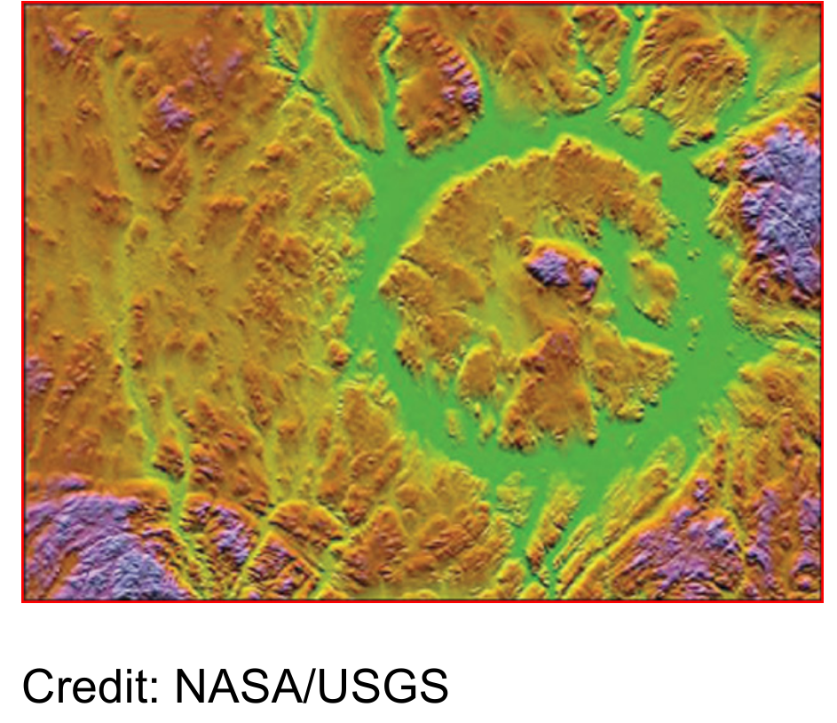
False-color image of Manicouagan Crater topography.
マニクアガンクレーター地形の偽色画像。
――――――――
Nov 26, 2007
カナダの巨大なリング状のクレーターは、流星の衝突の結果であると思われているようです。 電気的瘢痕はより良い説明ではないでしょうか?
地球上のいわゆる隕石衝突サイトに関する以前のThunderbolts「今日の写真」の記事で、機械的衝撃と熱応力以外の力を考慮すれば、クレーター内とその周辺の特徴をより簡単に説明できることを指摘しました。
〈https://takaakifukatsu.hatenablog.jp/entry/2021/08/22/185811〉
〈https://takaakifukatsu.hatenablog.jp/entry/2021/05/04/192051〉
より重要な考慮事項のいくつかは、衝突破片の欠如、複数の同心リング、ガラス化された小球、浅い窪み、および急な側壁です。
地球上で最大のそのような構造の1つは、カナダのケベックにあります。
マニクアガン・クレーターの座標は、北緯51度23分西経68度42分です。
〈https://earthobservatory.nasa.gov/images/1993/manicouagan-impact-structure-quebec〉
クレーターの幅は約100キロメートルで、中央の隆起領域は直径25キロメートルです。
その年齢は2億年以上と考えられています。
隆起した中央高原は、環状の湖の表面から約500メートル上にあり、リング状の構造を埋めており、山頂は800メートル近くあります。
クレーターの名前は、近くを流れるマニクアガン川に由来し、「樹皮がある場所」を意味します。
その名前はどうやら白樺の樹皮のカヌーの製造を指しています。
標準的な地質理論によれば、縞模様の比較的細かいパターンは、クレーターを取り巻く物質の多くが氷河の侵食によって洗い流されたことを示しています。
現在の地形の3倍の領域を囲んでいたクレーターの元の縁を含めて、ほぼ1キロメートルの上にある岩が取り除かれたと思われます。
隆起した中央台地は、侵食に強い火成岩と変成岩で構成されているため、従来の考え方ではほとんど摩耗していません。
ページ上部の画像では、南北方向の地形の傾斜を分析すると、影付きの色が作成されました。
北側の斜面は明るくなり、南側の斜面は暗くなります。
色は高さに関連しています。緑は最低の標高を示し、黄色、赤、マゼンタで増加し、最高の標高で青になります。
全体的な構造はリビアのケビラクレーターに似ています―
ケビラは直径31キロなので、マニクアガンよりはるかに小さいですが。
2つの形成は類似した形態を持つ他のクレーターのようであるため、私達は、それらの起源を調査するために同じ定性的手法を使用してみる事にします。
マニクアガン遺跡の周りには、途方もない衝撃波が地層を通過したことを示しているように見える鉱物があります。
多くの層で、生物起源の雲母は「ねじれたバンド」に見られます。
〈http://oldwebsite.laurentian.ca/geology/virtual/images/Misc/kinkbandsbx.jpg〉
クレーターを囲む層にもシャッター(粉砕)コーンが存在します。
[シャッターコーン(shatter cone)とは、巨大隕石衝突口の内部の岩肌などに形成され得る、表面に無数の溝を持った岩石のことである。]
〈https://ja.wikipedia.org/wiki/%E3%82%B7%E3%83%A3%E3%83%83%E3%82%BF%E3%83%BC%E3%82%B3%E3%83%BC%E3%83%B3〉
シャッターコーンは、岩を通る過圧の結果であり、独特のV字型の層に圧縮されています。
ほとんどの地質学者達は、シャッター(粉砕)コーンは気象影響シナリオの否定できない証拠であると信じているので、それらの存在は理論の確認を提供します。
世界の他の地域のクレーターが同じ効果を明らかにしているので、溶けた岩と融合した角礫岩も理論の確認であると考えられています。
しかし、時速45,000キロメートルで動く大きな岩の衝突がこれらのさまざまな現象の原因になる可能性がありますか、それとも電気力に答えを求める必要がありませんか?
シャッターコーンは、石を介した放電の証拠として解釈できます。
100キロメートルのクレーターを形成するのに十分強力な放電は、爆風の起源を指すシャッター(粉砕)コーンを生成するのに十分です。
したがって、南アフリカのフレデフォールト・ドームのシャッター(粉砕)コーンが下向きで、さまざまな起点を指していることは重要です。
衝突クレーターでは、粉砕コーンは一点を上向きにする必要があります。
〈https://takaakifukatsu.hatenablog.jp/entry/2020/06/29/195138〉
フレデフォールト・ドームは、回転するバークランド電流から予想されるような地下爆発の進行の証拠です。
「シャッターコーン」の特徴的なパターンを生成する別の可能なメカニズムがあります。
火星に関する他の「今日の写真」の記事では、信じられないほどのサイズのシャッターコーン・パターンが示されていました。
私達は、その形成を樹枝状の尾根として特定し、そして、その形状はマニクアガンのものと非常に似ています。
シャッターコーンは、石に保存されているリッチェンバーグ(リヒテンベルク)図形である可能性があります。
リッチェンバーグ図形は、これらのページで何度も取り上げられています。
それらは固体を通る放電の残骸であり、通過後に物質に特異な形状を残します。
〈https://takaakifukatsu.hatenablog.jp/entry/2021/05/22/140425〉
舗道や土壌への落雷により、爆発的な電流の流れによってリッチェンバーグ図形が刻まれたままになります。
〈http://capturedlightning.com/〉
放電の推定に基づくと、マニクアガンは他の場所で電気として説明されている特徴を表示する必要があります。
一例は、分散した破片の層化です。
回転する電気アークが土壌の層を通り抜け、溶けたスラグが地形を蛇行しながら広範囲に吹き飛ばされます。
実際、マニクアガン周辺の地質学的にユニークな鉱物のいくつかは、小さなガラス化された石の小滴としてイギリスで発見されています。
クレーターの周りにはいくつかの曲がりくねった路があり、衝突仮説では説明できないと思われる追加の証拠があります。
〈https://takaakifukatsu.hatenablog.jp/entry/2021/06/03/065226〉
一般に、世界中のいわゆる隕石クレーターのほとんどは、電気的な観点から再考する必要があります。
ミアウェザーインパクト(=衝突)構造、イトゥラルデ・インパクト(=衝突)構造、および他の多くのサイトは、大きな岩が宇宙から落ちた場所ではなく、放電起源である可能性があります。
〈https://craterexplorer.ca/merewether-structure/〉
〈https://photojournal.jpl.nasa.gov/jpeg/PIA03362.jpg〉
〈https://www.unb.ca/fredericton/science/research/passc/〉
By Stephen Smith
スティーブン・スミス著
――――――――
Nov 26, 2007
A giant ring-shaped crater in Canada seems to be the result of a meteor strike. Could electrical scarring be a better explanation?
カナダの巨大なリング状のクレーターは、流星の衝突の結果であると思われているようです。 電気的瘢痕はより良い説明ではないでしょうか?
In previous Thunderbolts Picture of the Day articles about so-called meteor impact sites on Earth, we pointed out that the features in and around the craters can be more readily explained if forces other than mechanical shock and thermal stress are considered.
地球上のいわゆる隕石衝突サイトに関する以前のThunderbolts「今日の写真」の記事で、機械的衝撃と熱応力以外の力を考慮すれば、クレーター内とその周辺の特徴をより簡単に説明できることを指摘しました。
〈https://takaakifukatsu.hatenablog.jp/entry/2021/08/22/185811〉
〈https://takaakifukatsu.hatenablog.jp/entry/2021/05/04/192051〉
Some of the more important considerations are the lack of impact debris, multiple concentric rings, glassified spherules, shallow depressions and steep sidewalls.
より重要な考慮事項のいくつかは、衝突破片の欠如、複数の同心リング、ガラス化された小球、浅い窪み、および急な側壁です。
One of the largest such structures on Earth is found in Quebec, Canada.
地球上で最大のそのような構造の1つは、カナダのケベックにあります。
Manicouagan crater's coordinates are N 51° 23' W 68° 42'.
マニクアガン・クレーターの座標は、北緯51度23分西経68度42分です。
〈https://earthobservatory.nasa.gov/images/1993/manicouagan-impact-structure-quebec〉
The crater is approximately 100 kilometers wide with a central uplift region 25 kilometers in diameter.
クレーターの幅は約100キロメートルで、中央の隆起領域は直径25キロメートルです。
Its age is thought to be over 200 million years.
その年齢は2億年以上と考えられています。
The uplifted central plateau rises almost 500 meters above the surface of the annular lake that fills-in the ring-shaped structure and the peak is close to 800 meters.
隆起した中央高原は、環状の湖の表面から約500メートル上にあり、リング状の構造を埋めており、山頂は800メートル近くあります。
The crater's name comes from the Manicouagan River that flows nearby and means, "the place where there is bark."
クレーターの名前は、近くを流れるマニクアガン川に由来し、「樹皮がある場所」を意味します。
The name apparently refers to the manufacture of birch bark canoes.
その名前はどうやら白樺の樹皮のカヌーの製造を指しています。
According to standard geological theory, a relatively fine pattern of striations indicates that much of the material surrounding the crater has been scoured away by glacial erosion.
標準的な地質理論によれば、縞模様の比較的細かいパターンは、クレーターを取り巻く物質の多くが氷河の侵食によって洗い流されたことを示しています。
Almost one kilometer of overlying rock is supposed to have been removed, including the crater's original rim that enclosed an area three-times greater than the current topography.
現在の地形の3倍の領域を囲んでいたクレーターの元の縁を含めて、ほぼ1キロメートルの上にある岩が取り除かれたと思われます。
The raised central plateau is composed of igneous and metamorphic rocks that are resistant to erosion so little of it was worn down according to conventional thinking.
隆起した中央台地は、侵食に強い火成岩と変成岩で構成されているため、従来の考え方ではほとんど摩耗していません。
In the image at the top of the page, analyzing the topographic slope in the north-south direction created the shaded colors.
ページ上部の画像では、南北方向の地形の傾斜を分析すると、影付きの色が作成されました。
Northern slopes are rendered bright and southern slopes are dark.
北側の斜面は明るくなり、南側の斜面は暗くなります。
The colors are related to height: green indicates the lowest elevations, increasing with yellow, red, and magenta, to blue at the highest elevations.
色は高さに関連しています。緑は最低の標高を示し、黄色、赤、マゼンタで増加し、最高の標高で青になります。
The overall structure is similar to Libya's Kebira crater –
although Kebira is 31 kilometers in diameter, much smaller than Manicouagan.
全体的な構造はリビアのケビラクレーターに似ています―
ケビラは直径31キロなので、マニクアガンよりはるかに小さいですが。
Because the two formations are like other craters with similar morphology, we may use the same qualitative techniques for investigating their origins.
2つの形成は類似した形態を持つ他のクレーターのようであるため、私達は、それらの起源を調査するために同じ定性的手法を使用してみる事にします。
Around the Manicouagan site are minerals that seem to indicate tremendous shockwaves have passed through the strata.
マニクアガン遺跡の周りには、途方もない衝撃波が地層を通過したことを示しているように見える鉱物があります。
In many layers, biotitic mica is found in "kinked bands."
多くの層で、生物起源の雲母は「ねじれたバンド」に見られます。
〈http://oldwebsite.laurentian.ca/geology/virtual/images/Misc/kinkbandsbx.jpg〉
Shattercones also exist in the layers surrounding the crater.
クレーターを囲む層にもシャッター(粉砕)コーンが存在します。
[シャッターコーン(shatter cone)とは、巨大隕石衝突口の内部の岩肌などに形成され得る、表面に無数の溝を持った岩石のことである。]
〈https://ja.wikipedia.org/wiki/%E3%82%B7%E3%83%A3%E3%83%83%E3%82%BF%E3%83%BC%E3%82%B3%E3%83%BC%E3%83%B3〉
Shattercones are the result of overpressure through the rock, causing it to compress in distinctive v-shaped formations.
シャッターコーンは、岩を通る過圧の結果であり、独特のV字型の層に圧縮されています。
Most geologists believe that shattercones are undeniable evidence for the meteoric impact scenario, so their presence provides confirmation for the theory.
ほとんどの地質学者達は、シャッター(粉砕)コーンは気象影響シナリオの否定できない証拠であると信じているので、それらの存在は理論の確認を提供します。
Melted rocks and fused breccias are also thought to be confirmation for the theory, since craters in other parts of the world reveal the same effects.
世界の他の地域のクレーターが同じ効果を明らかにしているので、溶けた岩と融合した角礫岩も理論の確認であると考えられています。
But can the impact of a big rock moving at 45,000 kilometers-per-hour be the cause of these various phenomena, or should we look to electrical forces for the answers?
しかし、時速45,000キロメートルで動く大きな岩の衝突がこれらのさまざまな現象の原因になる可能性がありますか、それとも電気力に答えを求める必要がありませんか?
Shattercones can be construed as evidence for electric discharges through the stone.
シャッターコーンは、石を介した放電の証拠として解釈できます。
A discharge powerful enough to form a 100-kilometer crater would be sufficient to generate shattercones pointing to the blast origin.
100キロメートルのクレーターを形成するのに十分強力な放電は、爆風の起源を指すシャッター(粉砕)コーンを生成するのに十分です。
It is significant, therefore, that shattercones in the Vredefort Dome, South Africa, point downwards and to different points of origin.
したがって、南アフリカのフレデフォールト・ドームのシャッター(粉砕)コーンが下向きで、さまざまな起点を指していることは重要です。
In an impact crater, the shattercones should point upwards to a single point.
衝突クレーターでは、粉砕コーンは一点を上向きにする必要があります。
〈https://takaakifukatsu.hatenablog.jp/entry/2020/06/29/195138〉
The Vredefort Dome is evidence for a traveling underground blast like that expected from a rotating Birkeland current.
フレデフォールト・ドームは、回転するバークランド電流から予想されるような地下爆発の進行の証拠です。
There is another possible mechanism that produces the characteristic pattern of a "shattercone."
「シャッターコーン」の特徴的なパターンを生成する別の可能なメカニズムがあります。
In other Picture of the Day articles about Mars, shattercone patterns of incredible size were illustrated.
火星に関する他の「今日の写真」の記事では、信じられないほどのサイズのシャッターコーン・パターンが示されていました。
We have identified the formations as dendritic ridges and their shape is remarkably similar to those in Manicouagan.
私達は、その形成を樹枝状の尾根として特定し、そして、その形状はマニクアガンのものと非常に似ています。
Shattercones may be Lichtenberg figures preserved in the stone.
シャッターコーンは、石に保存されているリッチェンバーグ(リヒテンベルク)図形である可能性があります。
Lichtenberg figures have been addressed many times in these pages.
リッチェンバーグ図形は、これらのページで何度も取り上げられています。
They are the remains of electric discharges through solids and they leave behind singular shapes in the material after their passage.
それらは固体を通る放電の残骸であり、通過後に物質に特異な形状を残します。
〈https://takaakifukatsu.hatenablog.jp/entry/2021/05/22/140425〉
Lightning strikes on pavement and in soils leave Lichtenberg figures carved into them by the explosive current flow.
舗道や土壌への落雷により、爆発的な電流の流れによってリッチェンバーグ図形が刻まれたままになります。
〈http://capturedlightning.com/〉
Based on the presumption of an electric discharge, Manicouagan ought to display those features that have been described elsewhere as electrical.
放電の推定に基づくと、マニクアガンは他の場所で電気として説明されている特徴を表示する必要があります。
One example is the layering of distributed debris.
一例は、分散した破片の層化です。
A spinning electric arc will machine down through layers of soil, blasting the melted slag across a wide area as it snakes through the terrain.
回転する電気アークが土壌の層を通り抜け、溶けたスラグが地形を蛇行しながら広範囲に吹き飛ばされます。
In fact, some of the geologically unique minerals around Manicouagan have been found in Great Britain as tiny glassified stone droplets.
実際、マニクアガン周辺の地質学的にユニークな鉱物のいくつかは、小さなガラス化された石の小滴としてイギリスで発見されています。
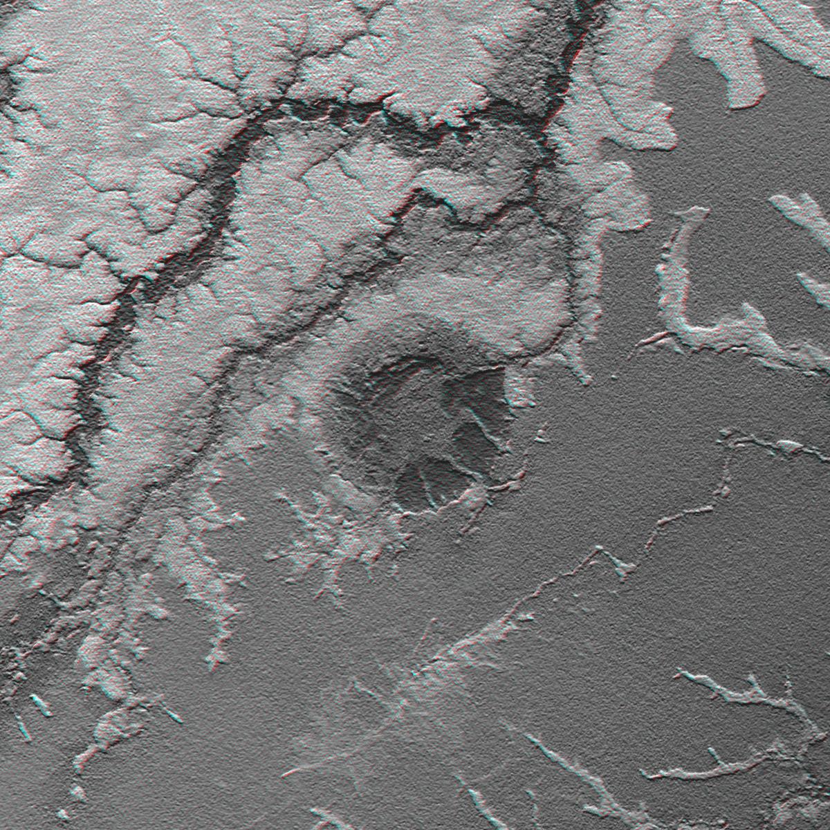
Surrounding the crater are several sinuous channels, additional evidence that the impact hypothesis cannot explain.
クレーターの周りにはいくつかの曲がりくねった路があり、衝突仮説では説明できないと思われる追加の証拠があります。
〈https://takaakifukatsu.hatenablog.jp/entry/2021/06/03/065226〉
In general, most of the so-called meteor craters around the world should be reconsidered from an electrical perspective.
一般に、世界中のいわゆる隕石クレーターのほとんどは、電気的な観点から再考する必要があります。
The Merewether Impact Structure, the Iturralde Impact Structure and many other sites could be of electric discharge origin and not where big rocks fell from space.
ミアウェザーインパクト(=衝突)構造、イトゥラルデ・インパクト(=衝突)構造、および他の多くのサイトは、大きな岩が宇宙から落ちた場所ではなく、放電起源である可能性があります。
〈https://craterexplorer.ca/merewether-structure/〉
〈https://photojournal.jpl.nasa.gov/jpeg/PIA03362.jpg〉
〈https://www.unb.ca/fredericton/science/research/passc/〉
By Stephen Smith
スティーブン・スミス著